
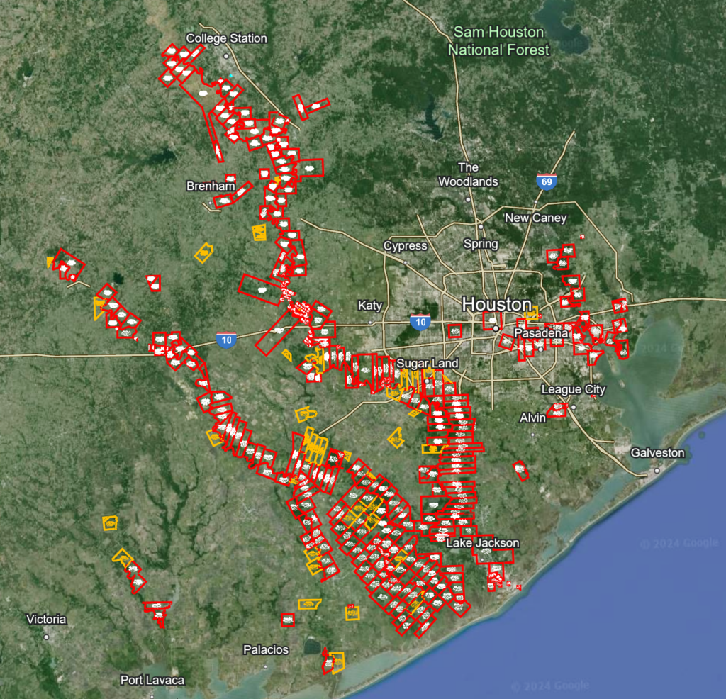
Bicentennial of Austin’s Colony Old 300 Land Grants
In early July 1824, Commissioner of Colonization Baron de Bastrop arrived at San Felipe de Austin and began issuing land titles to Empresario Stephen F. Austin’s first colonists. In July through mid-August of 1824, Bastrop issued titles to approximately 270 Mexican land grants, totaling over 1.5 million acres of land. These first families of Austin’s colony became known as the “Old 300” since Austin had been authorized to bring 300 families to Texas, under his colonization contract with the Mexican government. The remaining “Old 300” grants authorized under the first contract were issued at San Felipe in May and June of 1827, while grants under the second contract were also being issued.
The majority of these original land grants are located along the rivers and large creeks, especially the Brazos River which ran through the middle of Austin’s colony, bounded on the south by the Gulf of Mexico and the north by the Old San Antonio Road (El Camino Real).
The surveyors of Austin’s colony had been busy since late 1823, measuring and mapping the sitio and labor tracts being granted to immigrant settlers. The unit of measure was the Spanish vara which was established in Austin’s colony as being equal to 33.4 inches, but later became standardized across Texas as being equal to 33-1/3 inches. The sitio de tierra grants, intended for ranching, were one league (5000 varas) square, or a tract of equivalent area (25 million square varas). Based on the 33-1/3 inch vara standard, a square “league” of land was 4428.4 acres. The labor grants, intended for farming, were 1000 varas square, or a tract of equivalent area (1 million square varas), equal to 177.1 acres of land. Although Mexico began using the metric system of measurement in the mid-1800s, Texas still uses the vara as its official unit of measure for State-owned property.
The Texas General Land Office, established in 1836, has scans of the original land grant documents, surveys and maps available online at www.glo.texas.gov/ and www.historictexasmaps.com/
Please join surveyors, realtors, landmen, landowners and all interested citizens in celebrating this milestone anniversary in Texas history. To receive a free, interactive .kmz map file showing where the Old 300 land grants are located, please click here.
Once you have downloaded the file, go to https://earth.google.com/web and then click File, click Import KML/KMZ File. Import that file you just downloaded. You will then be able to see the interactive map.